






















In 2013 UPS began rolling out software called ORION that hands each driver an optimized sequence of stops every morning. Once fully deployed in 2016, UPS expected it to cut 100 million miles and 10 million gallons of fuel a year, worth $300 to $400 million, Transport Topics reported in August 2016. The algorithm took a decade to develop and test. Maps are one input, and GIS in logistics starts with them.
A geographic information system analyzes as well as displays
The USGS definition of a geographic information system has two verbs. A geographic information system analyzes and displays information tied to a location. A dashboard that pins trucks on a map does one thing. It displays. Route planning needs the first, and that part pays.
Georeferencing is where analysis starts. When a digital map is tied to ground coordinates, USGS says, basic map analysis becomes possible, such as calculating distances and areas. The raw material is public: the FAF5 network from the Bureau of Transportation Statistics holds 487,394 link features, equal to over 588,000 miles of road in the 48 contiguous states, DC, Alaska and Hawaii. It is a freight network, not every road. Its links are connected so that routing software can build paths over them and assign vehicles to those paths. A solver then chooses among the paths those links form.
ORION’s savings came in small units
INFORMS records what UPS built. ORION won the 2016 Franz Edelman Award. Once fully deployed, 55,000 US drivers were to rely on it, serving an average of 160 customers a day. The project was estimated to cost $250 million, and by UPS’s count it had saved more than $320 million by December 2015.
Jack Levis, UPS senior director of process management for corporate engineering, gave Transport Topics the small units. One mile less per driver per day is worth $50 million a year at UPS. One minute is worth $14.6 million. That is the scale. The software draws on fleet telematics data, customized maps and a proprietary algorithm. Levis’s point was that the savings come from many small ways to save a minute or a fraction of a mile.
One map, two routes
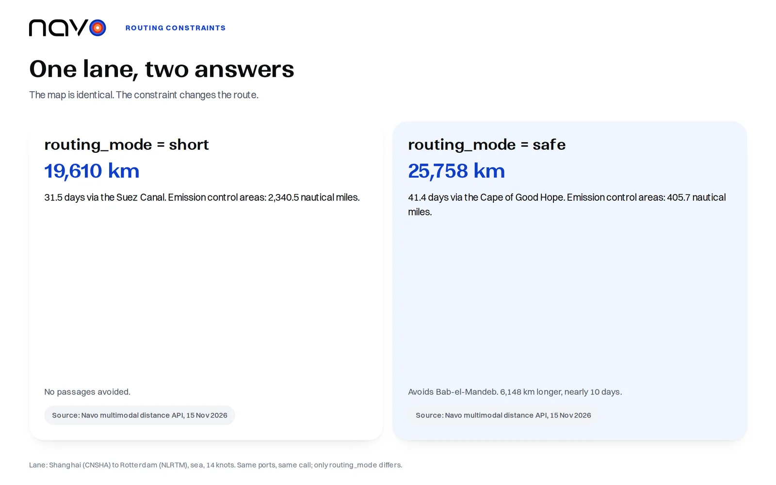
Two planners can read one network. They can still disagree. A live call to the Navo sea route API on 15 November 2026 shows how. The lane was Shanghai (CNSHA) to Rotterdam (NLRTM), by sea at 14 knots, with routing_mode set to short.
Short came back through the Suez Canal: 19,610.1 km, 31.5 days. Same ports. Same call. This time routing_mode was safe. The route now avoided Bab-el-Mandeb and ran round the Cape of Good Hope: 25,758.5 km, 41.4 days.
The Cape route adds 6,148 km and nearly ten days.
The emission control area stretch on the route fell too, from 2,340.5 nautical miles to 405.7. Both calls used one network, and the request carried the only change. Safe has been the default since 27 October 2026, so a caller who omits the setting gets the Cape route.
Put the setting beside the number
Both figures are steaming time, distance divided by speed. Port stays, canal transits and waiting depend on the service and have to be added by the caller. The ten days came from the constraint, so the constraint goes next to the figure.
Run the lane twice. For GIS in logistics, that is the cheapest audit there is. Send both modes through your routing tool and write the mode beside every transit time you give a customer. After that, a quote that moved when a strait closed has an explanation on file.
Frequently asked questions
Did ORION replace the planning system UPS already had?
No. The Operations Research and Management Science Today account says ORION sits on a package flow technology foundation that UPS launched in 2003, and INFORMS says ORION's cost and fuel savings come in addition to those already achieved by that earlier system.
How current is the FAF5 road network?
The FAF5 network links dataset was created from 2017 base year data. The Bureau of Transportation Statistics published it on April 11, 2022. It includes all roads from earlier FAF networks plus National Highway System and National Highway Freight Network roads open to traffic.
What speed range does the sea route call accept?
The speed_knots parameter takes 3 to 40 and defaults to 14. Points snap to the nearest point of the sea network.